Five Points

Oblique angle shot of bicycle locked to rack with Five Points cafe in background

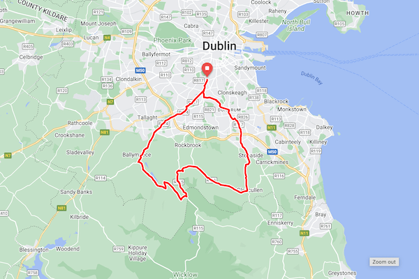
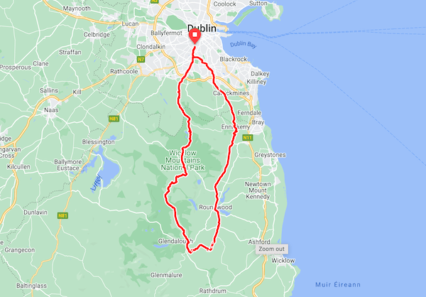
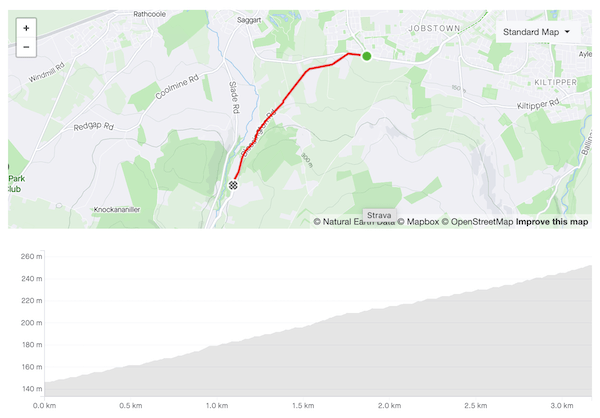
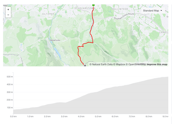
Ride distance: 46km.
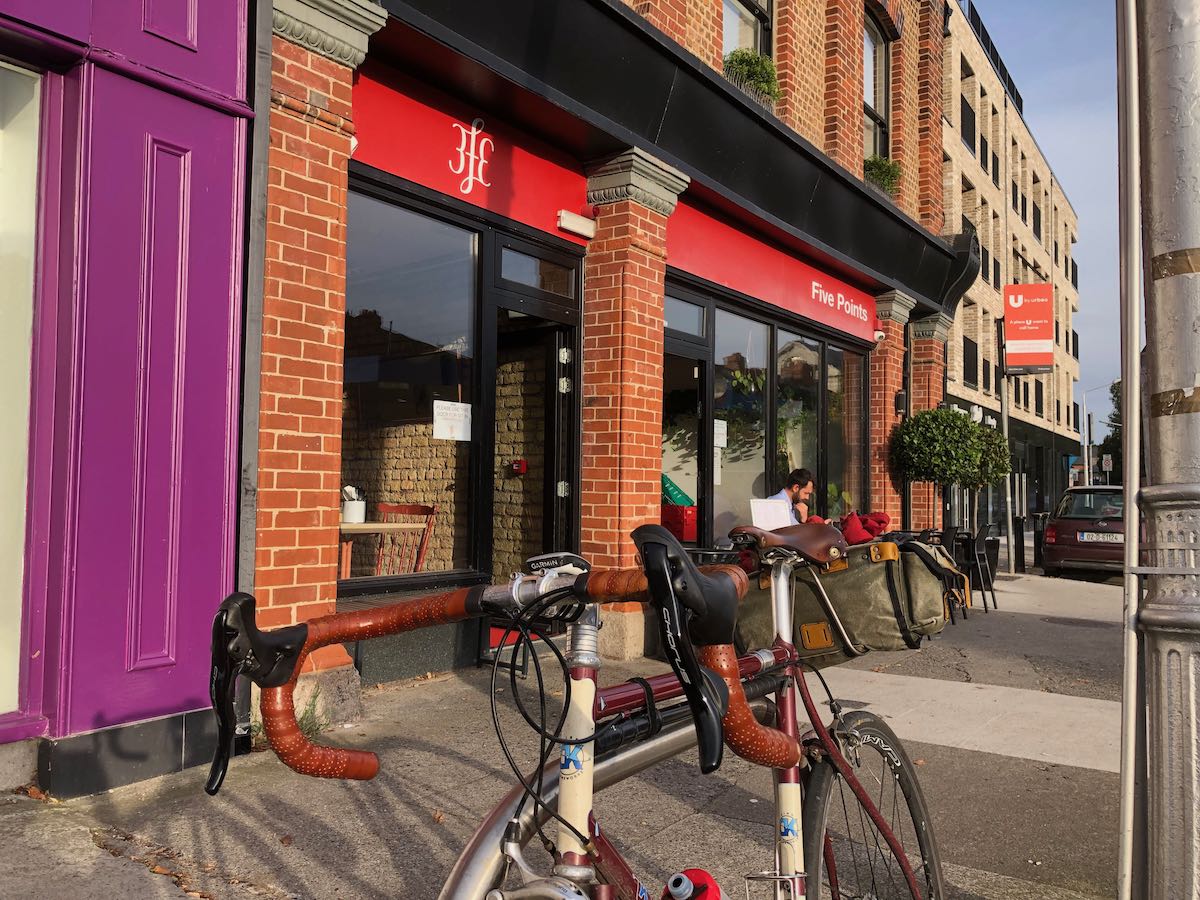
Beverage: 1 espresso (doppio)

Fittingly, the Coffeeneuring Challenge 2023 begins in the same place that every day begins for me, Five Points on the Harold’s Cross Road. Originally an independent fiefdom, Five Points was absorbed into the Borg-like 3FE empire a few years ago, trading the old blue livery for the current red. Though Five Points is no longer home to the best scones in Dublin, the espresso is reliably decent and the staff are reliably sound.

From there I head out through the empty Sunday morning streets of Terenure. This is rugby territory — improbably young boys are practising on the school playing fields, so small that when they line up to take a kick, the ball stands higher than their kneecaps. Older rugby fans are still in bed, nursing hangovers after Ireland’s win against Scotland last night. Just a handful of dog-walkers and serious runners getting the last few miles in before the Dublin Marathon.

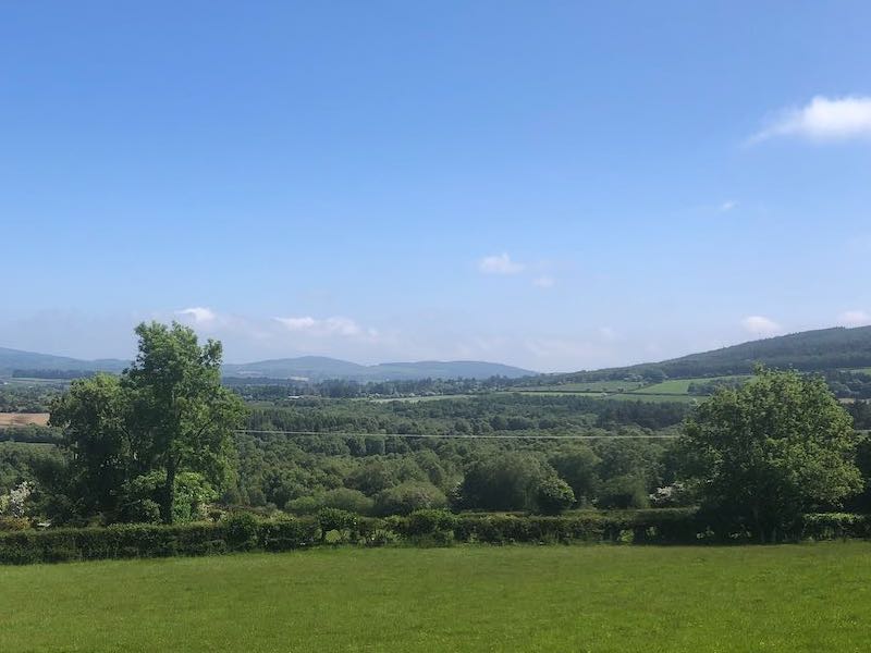
There’s no breeze until I reach the bridge over the M50. Suddenly a blast of tropical warm air, borne on a middling south-westerly. Warmer than any day in the wet July just gone, unseasonably warm. Climate change-y warm. I stash my gilet and arm warmers in the saddlebag, should have trusted in the forecast, implausible though it seemed.

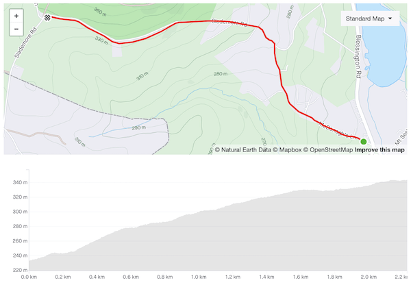
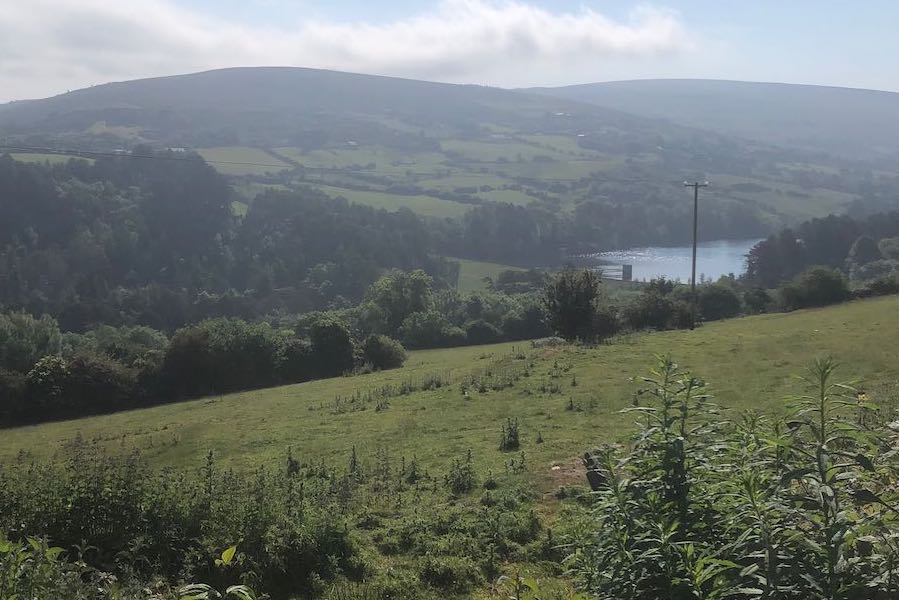
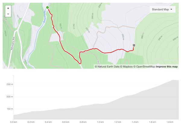
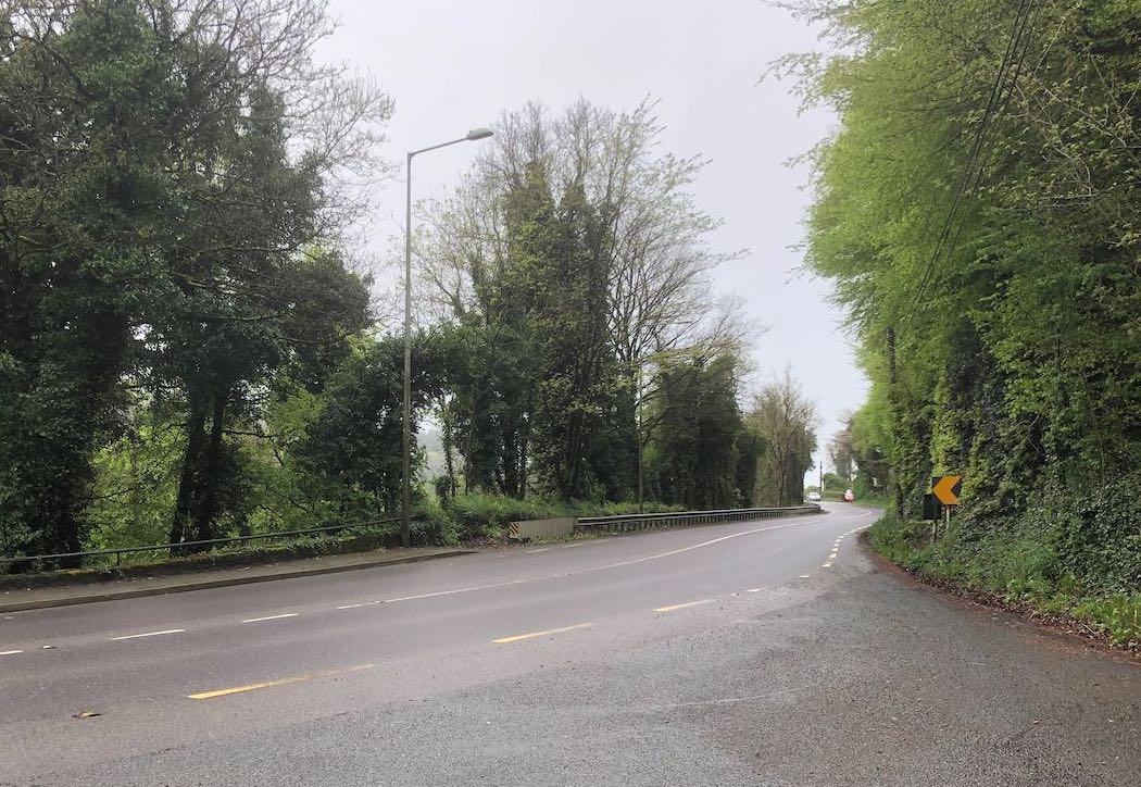
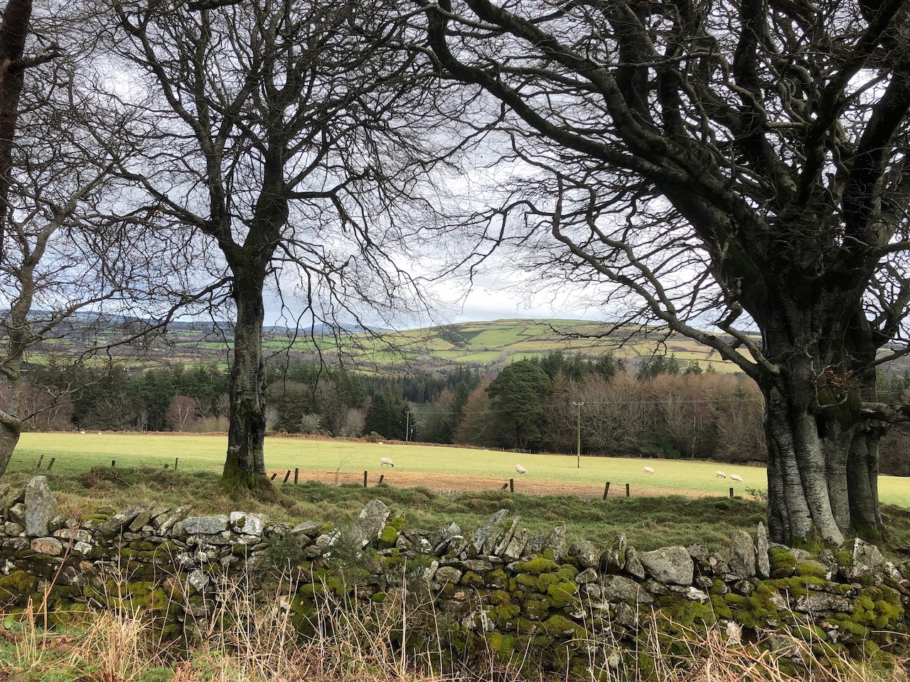
I take the back roads by Bohernabreena and Glenasmole up to the Featherbeds before dropping back down towards the city. A steady stream of cyclists with more stamina than me heading the opposite direction, Wicklow-bound. Two Garda cars parked up by the Noel Lemass memorial, where someone is setting up placards and loudspeakers; two more cars a little further down, Guards standing in the road eyeing approaching drivers with suspicion.

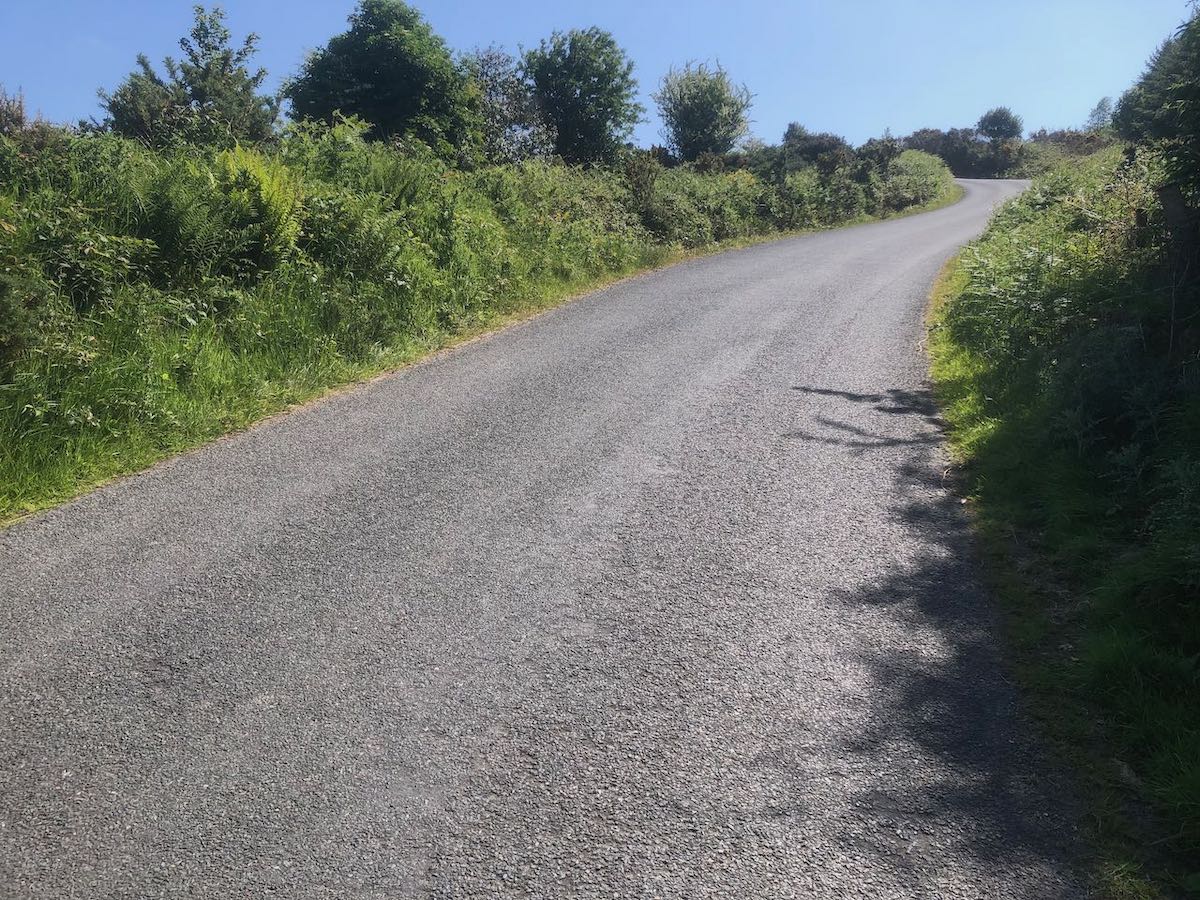
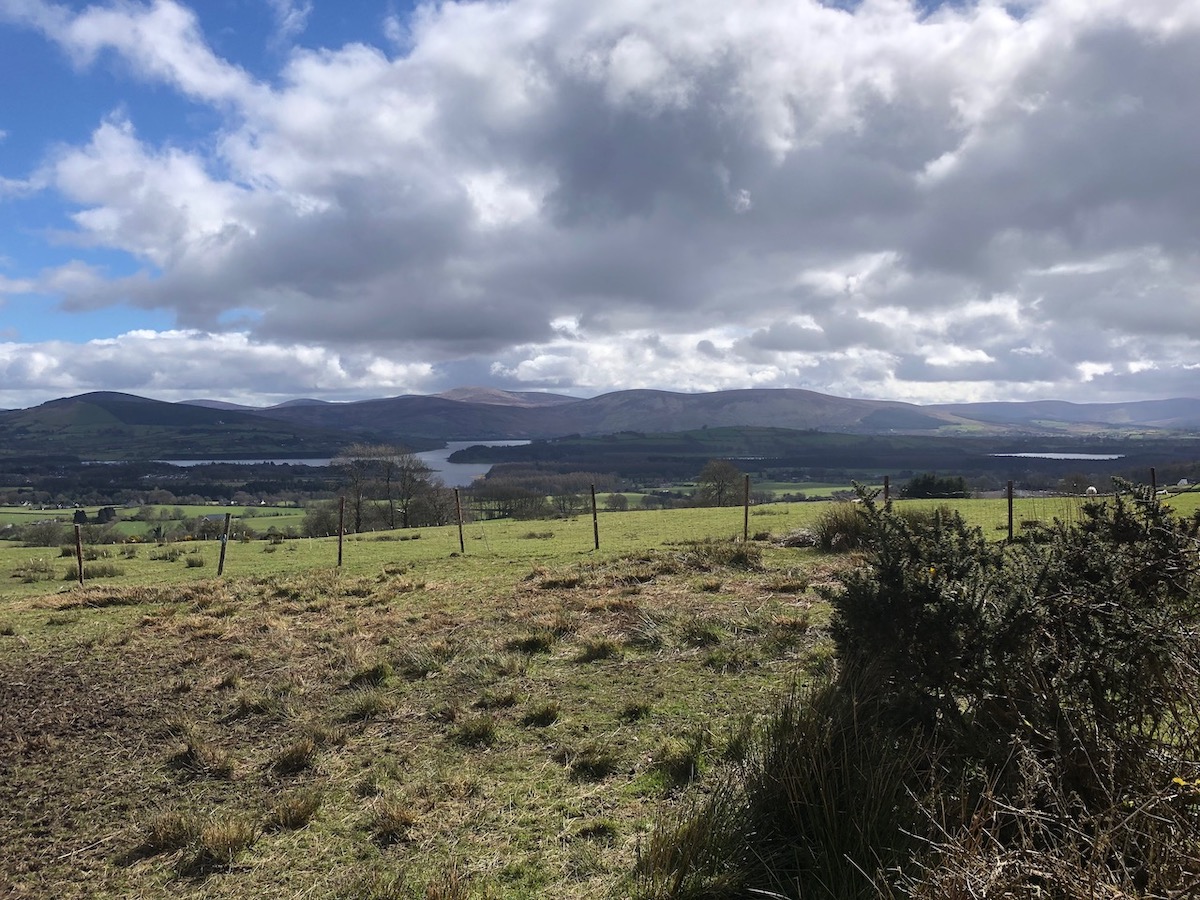
I swing around by Tibradden, past O’Connell’s Rock where two hundred years ago the Liberator delivered an oration to vast crowds. Hard to imagine walking up there from the city, yet few can have had horses or carriages to carry them. Cut left at Johnny Fox’s and over the last rise before the long descent all the way down to the river Dodder in Milltown.

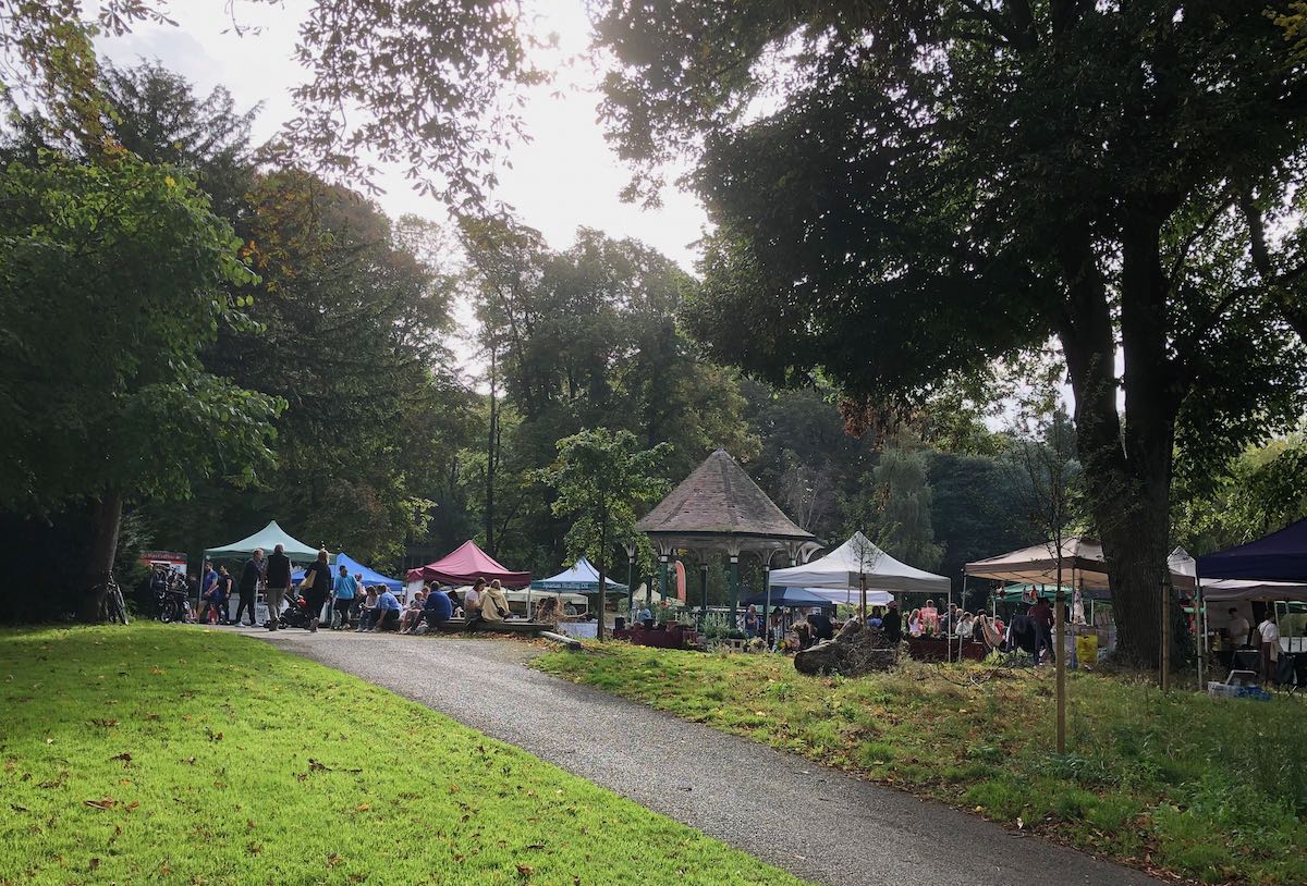
I detour by the market in Herbert Park and ride home with two musettes full of apples hanging from my neck, Holstein Coxes and Tipperary Pippins from Llewellyn’s orchard.

Market stalls clustered around a small bandstand in Herbert Park
The bourgeoisie of south Dublin in their element: Herbert Park Market

Chasing Mailboxes lays down the law for the Coffeneuring Challenge 2023. The challenge is straightforward (ride your bike and drink coffee seven times in seven weeks) but in keeping with the grand tradition of randonneuring established by Audax Club Parisien, there is an elaborate set of rules, some honoured more in the breach than the observance.

Burning Ambulance runs down the oeuvre of Hedvig Mollestad. I only know Black Stabat Mater (and fully endorse Phil’s praise) but this video of Ekhidna covering “Red” convinces me that I need to dig deeper.

Tone Glow top their hefty A.R. Kane interview with an even chunkier one with Hal Hartley. Last year I rewatched the video shop classics of my youth — The Unbelievable Truth, Trust, Simple Men, and Amateur — and they still hold up for me. Judging from the interview, I have a lot of catching up to do.

McDonagh’s Lane (2.2km, 111m, 5.0%)

Map and elevation profile of McDonagh's Lane climb

Strava

Prior to the lockdowns I had only ridden McDonagh’s Lane once, in the course of the gruelling Red Line/Red Lane 600, an experience that left me ill-inclined to revisit it. But its position just inside the boundaries of Dublin county offered plausible deniability, not that the Guards manning the checkpoints at Brittas ever bothered to stop me to check my credentials. It turns out to be a peach of climb — quiet, well-paved, and scenic.

The lane is easily overlooked, running up the side of the Blue Gardenia pub on the N81 around Brittas. Be in the small ring as you make the turn — the gradient quickly reaches double digits, then slackens briefly before rising to 15%. The impeccable surface of the road takes some of the sting out of the steep sections but they’re still demanding. The road is very narrow at this point so pray that you don’t meet a car coming the other way that might force you to stop.

The gradient eases as the road continues upwards in a series of steps. A slanted T-junction announces the final push — beware of vehicles coming from the right as you swing left around the bend — before the long drag to the top of the hill. Houses and neat hedges give way to pasture on the left and the edge of Saggart woods on the right, with the N81 trailing away down below. At the top, enjoy the sweeping vista of the mountains to the east and flat lands to the west, the Slieve Blooms barely breaking the horizon.

Handmade sign, painted on of planks nailed to a post: Aquatic Village, 7 days 10.30 until 6, No Tossers
Fair.

Bohernabreena Reservoir (45km, 695m)

Map of Bohernabreena Reservoir route

RideWithGPS

Categorised Climbs: Ballinascorney (First Section), Cunard Road Lower, Cunard Road Upper

Variation upon variation — this is a third way to skin the Piperstown/Glenasmole cat. It’s the most scenic option of the three, but also the hardest, featuring the short but salutary climb up Cunard Road Lower along with the demanding final kilometre of Cunard Road Upper. It would be hard to find a route that packs so much into a couple of hours so close to the city centre.

Head out of the city through Old Bawn and past the entrance to Bohernabreena reservoir to start the climb up to Ballinascorney. Take the left turn after the Footee course, as the road widens and curves right. The road above the reservoir is a joy: quiet, well-paved, tree-lined, with occasional glimpses of the water below. Follow the road around the back of the reservoir to a T-junction: left here, then the next right to take on the 15% ramp of Cunard Road Lower. Right at the top to join Cunard Road Upper — you’ll have a few moments to catch your breath before the grind up to the Featherbeds. Turn left at the T with Military Road, then the usual drop down by the Viewing Point and Cruagh Road to Tibradden, and along Pine Forest Road to Glencullen.

The only likely hazard (aside from knee trouble) is the descent down the back of the reservoir. The road itself is fine, but it’s winding and very narrow with no visibility around the corners — it’s very easy to round a corner at speed to meet a Land Rover coming the other way, with no scope for evasive manoeuvres. Don’t ask me how I know this.

Pasture leading down to the Upper Lake of Bohernabreena Reservoir, mountains in the background
The Upper Lake of Bohernabreena Reservoir, glittering in the sunshine

Trooperstown Hill (1.9km, 146m, 7.5%)

Map and elevation profile of Trooperstown Hill climb

Strava

At the time of writing, a mere 255 riders have ridden this segment on Strava, as compared to just shy of 10,000 for Wicklow Gap, so I feel confident in describing it as a hidden gem. You can find steeper, longer climbs on the west coast (Caherdaniel, may you live in infamy!) but there aren’t many other climbs in Wicklow that compare — Devil’s Glen, perhaps.

The headline numbers for the climb undersell it considerably. The gentle rise along the first kilometre from Bookey Bridge reduces the average gradient to an innocuous-seeming 7.5%, but the 900 meters after the turn average a very respectable 11% and the final ramp hits 18%. There are moments where the road appears to flatten but recovery is not easily come by — they’re still 8–9%.

The surface is heavy and there isn’t much to look at on the way up (you’ll be too busy trying to keep your front wheel planted anyway) but the views from the shoulder of the hill and the gradual descent on the other side are delightful.

Rough country road lined with hedgerows rising steeply to a left-hand bend
The final ramp. To quote Alice Cooper, “I’m eighteen…and I like it”

Trooperstown (93km, 1342m)

Map of Trooperstown route

RideWithGPS

Categorised Climbs: Edmondstown Road, Lough Bray, Trooperstown Hill

This route is a variation on the basic Laragh route, taking in the under-appreciated (and somewhat brutal) climb of Trooperstown Hill, so check the notes on that for the sections shared by both routes.

When you reach Laragh, go left at Lynham’s pub to take the road for Rathdrum. Take the left immediately before Bookey Bridge and climb gently for about a kilometer, then a sharp left onto the Trooperstown climb proper, which is anything but gentle. The reward comes afterwards, on the long, gradual descent around the curve of the hill — the views across the valley are lovely and you usually have the road entirely to yourself. There are a couple of tight bends and sections with loose gravel but it’s not particularly steep. At the bottom you run into the Moneystown road heading towards Roundwood. Rejoin the Laragh route just before the drag up to Ballinastoe.

The route works well in reverse too also, turning Trooperstown into a gentle, winding ascent. You’ll be riding the brakes all the way down the other side though.

Green fields and trees with mountains in the background under an almost cloudless blue sky
Looking north-east from Trooperstown Hill

The Embankment (3.2km, 106m, 3.3%)

Map and Elevation Profile of the Embankment climb

Strava

The Embankment only barely qualifies as a categorised climb, requiring judicious choice of start and end points to make the grade. It’s a rather featureless climb, three kilometers at a very steady 3–4% gradient along the N81. Despite being an N-road, the N81 is fairly narrow, with little in the way of hard shoulder to hide in as the HGVs thunder past. There’s nothing much in the way of scenery.

So why mention it? Because it has the cardinal virtue of being the only easy route out of the city towards Blessington — the fallback option when you can’t face another grind up Ballinascorney or Mount Seskin. Buckled after a hard ride yesterday? Crippled with a hangover? Recovering from yet another dose of Covid? The Embankment is your friend. During the winter when other roads are slick with frost, the N81 sees enough traffic to melt it off. The surface is uniformly good, with barely a pothole in sight. It’s sheltered from the prevailing westerly winds.

And, of course, it’s perfect for riding fixed gear — if you have any legs at all, you can storm up it in a single out-of-the-saddle effort, humming “The Ride of the Valkyries” to yourself as you go. I’ve crawled up Seskin on fixed and it’s not an experience I’d care to repeat. I can’t imagine making it over Ballinascorney on a single cog. But the Embankment gives easy access to the gentler roads of west Wicklow, and after a couple of bleak months riding around Kildare and north county Dublin, you’ll be very glad it’s there.

Wet road between tree-lined verges under slate grey sky
The top of the Embankment…as you can see, it’s all charm

Bishopshill (84km, 992m)

Map of Bishopshill route

RideWithGPS

Categorised Climbs: Ballinascorney, McDonagh’s Lane, Bishopshill Road

A five-star route: classic climbs, quiet roads, beautiful scenery. There are very few routes in the Dublin area which pack so much into a ride you can finish before lunchtime. This is my Ardennes Week route — maybe there’s nothing here to match the Mur de Huy or La Redoute but there are punchy ramps steep enough to get your attention.

The early section following the R114 over Ballinascorney to Brittas is fairly routine, but provides a good warm-up for the ascent of McDonagh’s Lane that awaits on the far side of the N81. Follow the road around the back side of Slade Valley and along the ridge before dropping down to a crossroads. Turn left for Kilteel and Eadestown. This is the westernmost edge of the Dublin mountains — to your right only the flat expanse of the midlands. The few hills visible on the horizon are a couple of counties away.

A few kilometres after Eadestown, the road begins to rise, presaging the final categorised climb of the day, Bishopshill Road. The steep ramps on the lower reaches of the climb are more than compensated by the views of Poulaphouca reservoir and Blessington from the top. Drop down into Ballymore Eustace, and up to the N81, before making a quick loop around Tulfarris and returning to Dublin via Blessington, Manor Kilbride and Ballinascorney.

There are few hazards along the way: the descent after Slade Valley is steep and badly paved but doesn’t see much traffic so you can usually pick your way down without trouble. Best taken handy, nonetheless. You’re on the N81 for a stretch coming into Blessington but it’s flat, well-paved, and you often have a tailwind so it passes quickly.

There is scope for variation: if you want a shorter route, turn left at the T-junction at 36km (after Bishopshill) to cut straight back to Blessington. This lops nearly 20km off the route although you’re missing a lot of pleasant cycling by the reservoir. You can take a different look at the hill by continuing past Bishopshill Road and taking the next left instead — you miss some of the views but it’s a steadier climb. And if the R114 is getting you down, you can take the road up Mount Seskin to Brittas instead.

The view from Bishopshill Road: Poulaphouca reservoir with the Wicklow mountains in the background, underneath a partly blue, partly cloudy sky
Worth waiting for: Poulaphouca nestled beneath the mountains

Edmondstown Road (9.1km, 432m, 4.7%)

Map and elevation profile of Edmondstown Road climb

Strava

Edmondstown Road and Stocking Lane are the fraternal twins of the Dublin Mountains, two climbs connecting the same two points, recognisably related but each with its own distinct character. Of the two, Edmondstown Road is the longer and gentler, and the option I prefer at the start of longer rides — the steep ramp on Stocking Lane can deaden the legs if you’re out of shape. But they’re both terrific, and you can substitute them as the moment takes you on any route heading out along the Military Road.

The climb proceeds upwards in steps—an initial gentle rise to Edmondstown golf club flattens to pass under the M50, then becomes steeper as you pass the Merry Ploughboy. There’s another respite section after the turn-off for Mount Venus Road, dropping down a few metres to the longest ramp: 1.4km varying between 8–11%. The road winds left and right under the trees until you shank left over a small bridge, then right past the turn-off for Glencullen.

The gradient eases off, but the road surface deteriorates, the council having taken a distinctly (perversely, one might say) piecemeal approach to repaving the road. Passing the entrance to Cruagh Woods, you say goodbye to double-digit gradients, then make a couple of hairpins to arrive at the Viewing Point.

If this is your very first time there, it is acceptable to join the crowds taking selfies with the city in the background. Otherwise, take the sharp left onto Military Road and keep going. The last 2.5km ease gradually from 7% down to 2% as you approach the Noel Lemass memorial, but the road is well-surfaced to the county line, and you’ll be held back more by the wind which will hit you as soon as you emerge from the trees.

The descent is just as enjoyable as the climb, straight and  blazing fast in parts, technical in others. Keep your wits about you as pass the Cruagh Woods car park—particularly on weekends and holidays, you’ll often encounter drivers engaged in emergency manoeuvres, and stray dogs or children.

The view from Cruagh Road: green fields dropping away under partly cloudy skies, Dublin city and bay visible in the background.
The view from Cruagh Road

Laragh (89km, 1310m)

Map of Laragh route

RideWithGPS

Categorised Climbs: Edmondstown Road, Lough Bray, L1059, Oldbridge (E)

This is classic Wicklow cycling: the windswept bogs of the mountains, the quiet roads through sloping pastures in the lowlands. The route is packed with climbing, from the headline ascent to Sally Gap to the rollercoaster roads around Oldbridge, finishing with the uncategorised duo of the Poggio and the Scalp. Reversing it gives not just another perspective on the countryside but a different, no less satisfying, rhythm to the day.

Navigationally, the route is very simple: only two turns separate the start at Five Points and the halfway point at Laragh, and there are only a few more on the return leg. You climb to Sally Gap in two stages, taking the marginally gentler Edmondstown Road route up to the Featherbeds, then dropping down to Glencree before tackling the climb past Lough Bray. After the Gap you descend gradually for 15km to Laragh. Immediately after leaving Laragh take the left turn onto the backroad to Oldbridge. This road is perhaps the highlight of the route, quickly leaving the village behind to take you past tranquil fields lined with hedgerows and dry stone walls. Jink right at the R759, then left for Ballinastoe. After descending the Old Long Hill, there’s the quick kick of the Poggio and then the gentle slopes of the Scalp before the descent back into the city.

There are a few hazard points to watch out for. As you are picking up speed towards the top of Glenmacnass waterfall, the road swings left — you will frequently round this bend to find a slew of blithe tourists milling around in the road. Be ready for an emergency stop. The second is the descent into Oldbridge. There is a trio of warning signs, starting with an arresting (but unhelpfully unspecific) “!”, then one showing a bike sliding, and finally one warning of a 10% gradient (a gross underestimate, as you will find out if you ever travel it in the opposite direction). It would be pretty easy to come a cropper here. Finally, the descent of the Old Long Hill ends with a tight left-hand bend ending abruptly at a T-junction. Ignore the warning sign at your peril.

Laragh is the obvious place for a cafe stop — there’s nothing before it, and nothing afterwards until you reach Enniskerry. The route runs you straight past Glendalough Green (aka the Hippie Cafe), the traditional stop for cyclists. On a warm day, the outdoor seating will be thronged with the lycra-clad hordes, basking in the sunshine like seals on a rock. Lynham’s does a reasonable pub lunch, and there’s also a food truck doing barbecue in their carpark on summer weekends. There is a petrol station shop just off the route on the Glendalough Road.

There’s some scope for variation: if you’re already jacked by the time you get to Laragh, you may prefer the gentle drag along the R755 through Annamoe to Roundwood over the focused ramps on the L1059 to Oldbridge. Bear left as you exit Roundwood to get onto the road for Ballinastoe. Gluttons for punishment can turn left at the R759 (56km) to take on the steepest approach to Sally Gap, the road above Luggala Estate, and return to the city from the Gap.

View of a valley, across a field, framed by gnarled trees on either side and an old stone wall at the bottom.
The view across the valley to Trooperstown Hill from the Oldbridge Road.