McDonagh’s Lane (2.2km, 111m, 5.0%)

Map and elevation profile of McDonagh's Lane climb

Strava

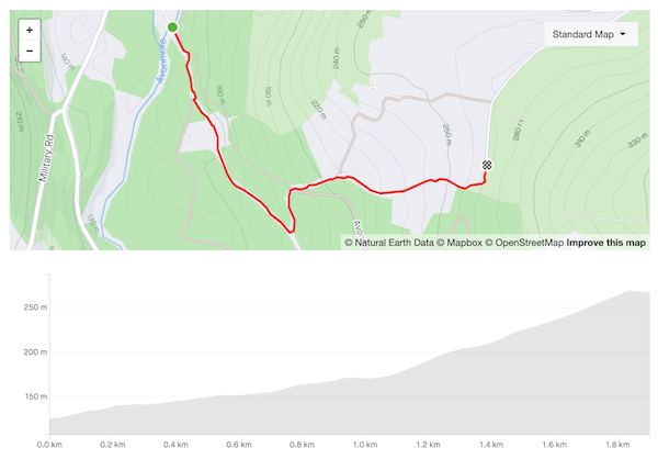
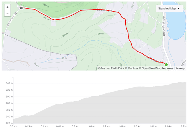
Prior to the lockdowns I had only ridden McDonagh’s Lane once, in the course of the gruelling Red Line/Red Lane 600, an experience that left me ill-inclined to revisit it. But its position just inside the boundaries of Dublin county offered plausible deniability, not that the Guards manning the checkpoints at Brittas ever bothered to stop me to check my credentials. It turns out to be a peach of climb — quiet, well-paved, and scenic.

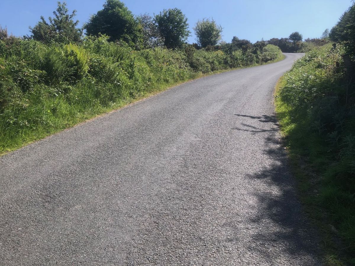
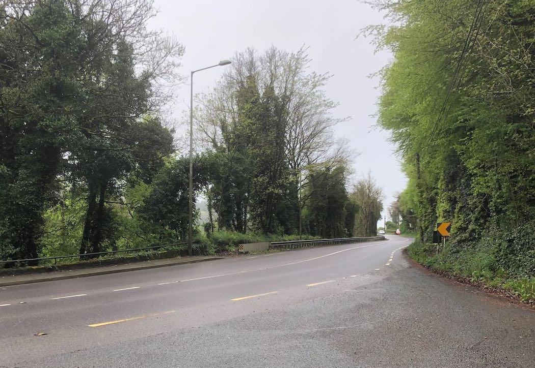
The lane is easily overlooked, running up the side of the Blue Gardenia pub on the N81 around Brittas. Be in the small ring as you make the turn — the gradient quickly reaches double digits, then slackens briefly before rising to 15%. The impeccable surface of the road takes some of the sting out of the steep sections but they’re still demanding. The road is very narrow at this point so pray that you don’t meet a car coming the other way that might force you to stop.

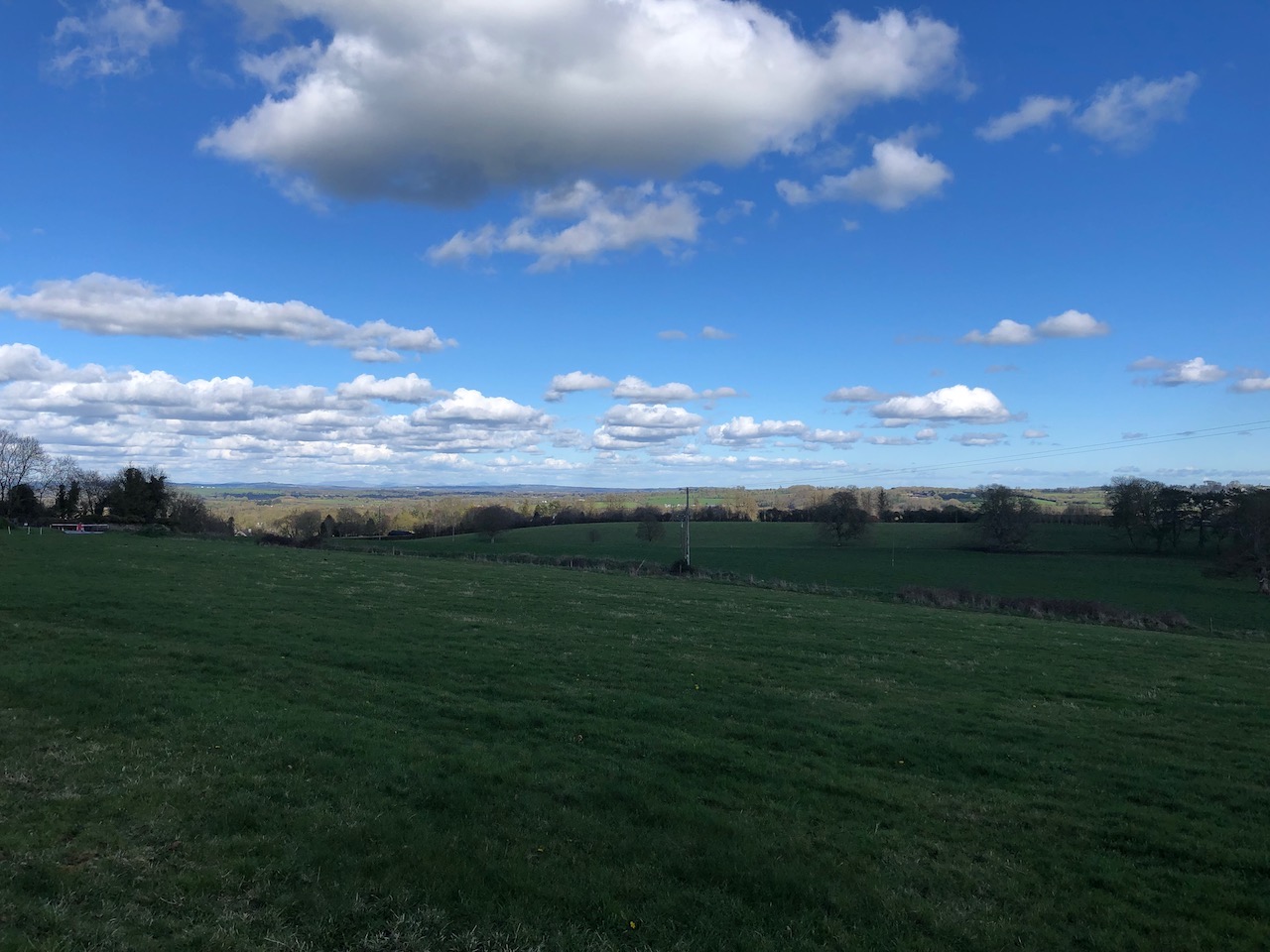
The gradient eases as the road continues upwards in a series of steps. A slanted T-junction announces the final push — beware of vehicles coming from the right as you swing left around the bend — before the long drag to the top of the hill. Houses and neat hedges give way to pasture on the left and the edge of Saggart woods on the right, with the N81 trailing away down below. At the top, enjoy the sweeping vista of the mountains to the east and flat lands to the west, the Slieve Blooms barely breaking the horizon.

Handmade sign, painted on of planks nailed to a post: Aquatic Village, 7 days 10.30 until 6, No Tossers
Fair.

Trooperstown Hill (1.9km, 146m, 7.5%)

Map and elevation profile of Trooperstown Hill climb

Strava

At the time of writing, a mere 255 riders have ridden this segment on Strava, as compared to just shy of 10,000 for Wicklow Gap, so I feel confident in describing it as a hidden gem. You can find steeper, longer climbs on the west coast (Caherdaniel, may you live in infamy!) but there aren’t many other climbs in Wicklow that compare — Devil’s Glen, perhaps.

The headline numbers for the climb undersell it considerably. The gentle rise along the first kilometre from Bookey Bridge reduces the average gradient to an innocuous-seeming 7.5%, but the 900 meters after the turn average a very respectable 11% and the final ramp hits 18%. There are moments where the road appears to flatten but recovery is not easily come by — they’re still 8–9%.

The surface is heavy and there isn’t much to look at on the way up (you’ll be too busy trying to keep your front wheel planted anyway) but the views from the shoulder of the hill and the gradual descent on the other side are delightful.

Rough country road lined with hedgerows rising steeply to a left-hand bend
The final ramp. To quote Alice Cooper, “I’m eighteen…and I like it”

The Embankment (3.2km, 106m, 3.3%)

Map and Elevation Profile of the Embankment climb

Strava

The Embankment only barely qualifies as a categorised climb, requiring judicious choice of start and end points to make the grade. It’s a rather featureless climb, three kilometers at a very steady 3–4% gradient along the N81. Despite being an N-road, the N81 is fairly narrow, with little in the way of hard shoulder to hide in as the HGVs thunder past. There’s nothing much in the way of scenery.

So why mention it? Because it has the cardinal virtue of being the only easy route out of the city towards Blessington — the fallback option when you can’t face another grind up Ballinascorney or Mount Seskin. Buckled after a hard ride yesterday? Crippled with a hangover? Recovering from yet another dose of Covid? The Embankment is your friend. During the winter when other roads are slick with frost, the N81 sees enough traffic to melt it off. The surface is uniformly good, with barely a pothole in sight. It’s sheltered from the prevailing westerly winds.

And, of course, it’s perfect for riding fixed gear — if you have any legs at all, you can storm up it in a single out-of-the-saddle effort, humming “The Ride of the Valkyries” to yourself as you go. I’ve crawled up Seskin on fixed and it’s not an experience I’d care to repeat. I can’t imagine making it over Ballinascorney on a single cog. But the Embankment gives easy access to the gentler roads of west Wicklow, and after a couple of bleak months riding around Kildare and north county Dublin, you’ll be very glad it’s there.

Wet road between tree-lined verges under slate grey sky
The top of the Embankment…as you can see, it’s all charm

The Hill of Tara (2.9km, 103m, 3.3%)

Map and elevation profile of Hill of Tara climb

Strava

For all its cultural significance, the Hill of Tara is not much of an eminence — in order for it even to scrape into Category 4, you have to include the road approaching the climb proper. At the top of the initial ramp, take the left turn, then right at the next crossroads; both turns are signposted for a cycle route. From there it’s a straight line to the top — it’s a pretty road, lined with hedgerows and mature trees, but it’s so narrow that it will be a tight squeeze if you meet any cars coming in the opposite direction. The steepest gradient comes in the middle of the hill, at around 9%.

The view looking north-east from the Hill of Tara — green fields under a blue sky with scattered cloud
Looking north-east towards Drogheda from the car park at the summit