Bohernabreena Reservoir (45km, 695m)

Map of Bohernabreena Reservoir route

RideWithGPS

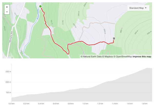
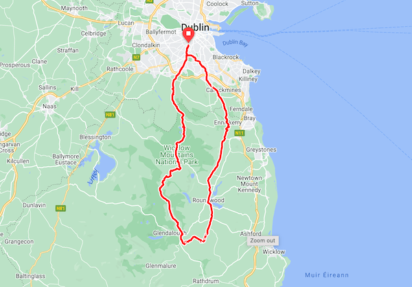
Categorised Climbs: Ballinascorney (First Section), Cunard Road Lower, Cunard Road Upper

Variation upon variation — this is a third way to skin the Piperstown/Glenasmole cat. It’s the most scenic option of the three, but also the hardest, featuring the short but salutary climb up Cunard Road Lower along with the demanding final kilometre of Cunard Road Upper. It would be hard to find a route that packs so much into a couple of hours so close to the city centre.

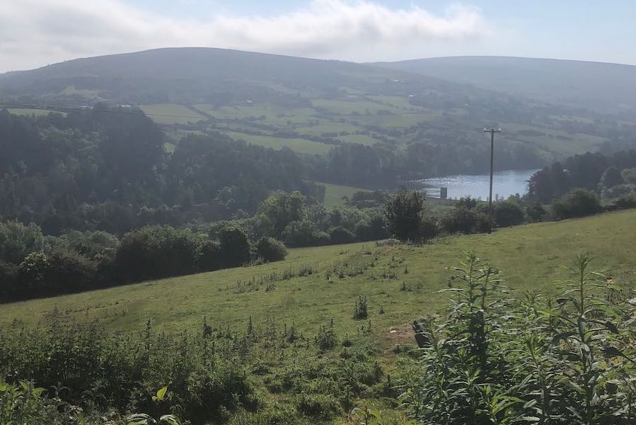
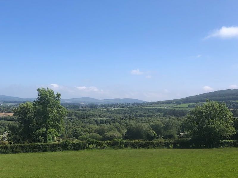
Head out of the city through Old Bawn and past the entrance to Bohernabreena reservoir to start the climb up to Ballinascorney. Take the left turn after the Footee course, as the road widens and curves right. The road above the reservoir is a joy: quiet, well-paved, tree-lined, with occasional glimpses of the water below. Follow the road around the back of the reservoir to a T-junction: left here, then the next right to take on the 15% ramp of Cunard Road Lower. Right at the top to join Cunard Road Upper — you’ll have a few moments to catch your breath before the grind up to the Featherbeds. Turn left at the T with Military Road, then the usual drop down by the Viewing Point and Cruagh Road to Tibradden, and along Pine Forest Road to Glencullen.

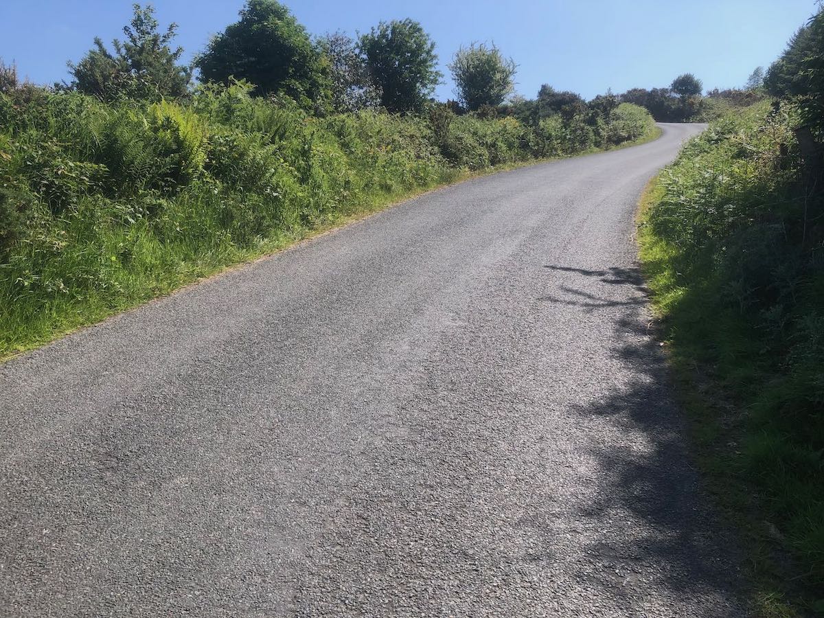
The only likely hazard (aside from knee trouble) is the descent down the back of the reservoir. The road itself is fine, but it’s winding and very narrow with no visibility around the corners — it’s very easy to round a corner at speed to meet a Land Rover coming the other way, with no scope for evasive manoeuvres. Don’t ask me how I know this.

Pasture leading down to the Upper Lake of Bohernabreena Reservoir, mountains in the background
The Upper Lake of Bohernabreena Reservoir, glittering in the sunshine

Lotta Continua

Rectangular white and blue sign reading Pure Mile No Littering Please on a post at the roadside

I must have cycled past PURE Mile signs hundreds of times before I finally checked to see what they were, who was behind them. PURE (Protecting Uplands and Rural Environments) works to reduce littering and illegal dumping in the Dublin and Wicklow mountains. There’s a welter of local government and semi-state bodies involved, but the litter-picking is mostly done by groups of volunteers. PURE provide the equipment and collect the filled rubbish sacks. The website doesn’t provide any obvious means of getting in contact with nearby groups, which seems like an omission, but after a string of emails and a couple of false starts, Celeste got us on the distribution list for the Friends of the South Dublin Uplands. Largely drawn from a hiking club, the Friends meet every month or two to clean up Military Road, Piperstown Road and Cunard Road, some of my favourite roads to cycle.

Spending an hour or two of a Sunday morning walking the verges and clambering over ditches with a litter-picker and blue rubbish sack in hand gives you pause for thought about your fellow man. I mean, we’ve all had evenings where, faced with the prospect of doing the dishes, it seemed easier to load the lot into the back of a car, drive up into the mountains, and smash the entire dinner service, plate by plate, in a lay-by. I can imagine that in the rosy post-coital glow, it seems less than urgent to retrieve your jocks from the thicket of brambles where you flung them in the throes of raw animal passion. But I struggle to fathom the purblind selfishness behind the most routine littering, the scurf of plastic bottles and coffee cups dropped from the windows of passing cars (unsurprisingly, far heavier on the side of the road outbound from Dublin). I am compiling a list of products that should henceforth be sold only under license, with stringent requirements around traceability and disposal: wet wipes, nitrous oxide canisters, and Red Bull are top of the list.

Nature engulfs some of these alien artefacts impressively quickly — you often step on what appears to be solid turf only to hear the crumple of a plastic bottle, prelude to a couple of minutes wrestling to unearth the errant container. But the rest remain an eyesore, a constant visual reminder of human thoughtlessness and waste. On the last Sunday excursion, I filled nearly three sacks with the detritus scattered along lightly-trafficked Cunard Road, all discarded in the month since the previous pick. It’s satisfying work, but Sisyphean — I’ve passed along our stretch of Military Road a couple of times since and already a fresh crop is sprouting.

Blue plastic rubbish sack with Pure branding, standing on a ditch, mountains in the background
The Blue Bag of Happiness

Trooperstown Hill (1.9km, 146m, 7.5%)

Map and elevation profile of Trooperstown Hill climb

Strava

At the time of writing, a mere 255 riders have ridden this segment on Strava, as compared to just shy of 10,000 for Wicklow Gap, so I feel confident in describing it as a hidden gem. You can find steeper, longer climbs on the west coast (Caherdaniel, may you live in infamy!) but there aren’t many other climbs in Wicklow that compare — Devil’s Glen, perhaps.

The headline numbers for the climb undersell it considerably. The gentle rise along the first kilometre from Bookey Bridge reduces the average gradient to an innocuous-seeming 7.5%, but the 900 meters after the turn average a very respectable 11% and the final ramp hits 18%. There are moments where the road appears to flatten but recovery is not easily come by — they’re still 8–9%.

The surface is heavy and there isn’t much to look at on the way up (you’ll be too busy trying to keep your front wheel planted anyway) but the views from the shoulder of the hill and the gradual descent on the other side are delightful.

Rough country road lined with hedgerows rising steeply to a left-hand bend
The final ramp. To quote Alice Cooper, “I’m eighteen…and I like it”

Trooperstown (93km, 1342m)

Map of Trooperstown route

RideWithGPS

Categorised Climbs: Edmondstown Road, Lough Bray, Trooperstown Hill

This route is a variation on the basic Laragh route, taking in the under-appreciated (and somewhat brutal) climb of Trooperstown Hill, so check the notes on that for the sections shared by both routes.

When you reach Laragh, go left at Lynham’s pub to take the road for Rathdrum. Take the left immediately before Bookey Bridge and climb gently for about a kilometer, then a sharp left onto the Trooperstown climb proper, which is anything but gentle. The reward comes afterwards, on the long, gradual descent around the curve of the hill — the views across the valley are lovely and you usually have the road entirely to yourself. There are a couple of tight bends and sections with loose gravel but it’s not particularly steep. At the bottom you run into the Moneystown road heading towards Roundwood. Rejoin the Laragh route just before the drag up to Ballinastoe.

The route works well in reverse too also, turning Trooperstown into a gentle, winding ascent. You’ll be riding the brakes all the way down the other side though.

Green fields and trees with mountains in the background under an almost cloudless blue sky
Looking north-east from Trooperstown Hill